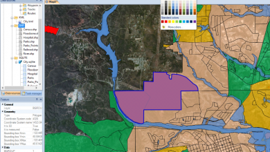
Undervisning CAD / GISGeospatial - GIS
Geospatiale arrangementer juni 2008
Her er nogle arrangementer, der finder sted i juni

| dato | Lugar | Evento |
| 1-6 | Mytilene, Lesvos, Grækenland | Tjen konference |
| 2-3 | Estes Park CO, USA | Geo Gathering 2008 |
| 2-5 | Ottawa, Canada | GeoTec 2008-begivenhed |
| 2-5 | Las Vegas TX, USA | Intergraph 2008 |
| 8 | Potsdam, Tyskland | OGC teknisk Interoperabilitets dag |
| 8-11 | Ontario, Canada | Kommunernes Oplysningstjeneste Foreningens Årskonference MISA) En |
| 8-12 | Atlanta GA, USA | Konference og udstilling årligt ACE08 |
| 9-12 | Rom, Italien | Årlig konference for European Association of Geoengineers EAGE 2008 |
| 10, 12, 17 | Bilbao, Sevilla og Santiago Compostela | Seminar "BENTLEY: ét produkt, én løsning" |
| 12 | Norcross, GA, USA | Du ERDAS GeoConnect 2008 |
| 12 | Valencia, Spanien | Byretskonference ICAV |
| 10-13 | St. Pete Beach, FL, USA | Klimainformation for Risikostyring: Samarbejde og løsninger for landbrug og naturressourcer |
| 16-18 | snefugl utah ERE |
VIII årlige konference for Azteca Systems Cityworks brugere E-mail: lferguson@azteca.com www.azteca.com |
| 16-20 | Havana, Cuba | TROPICO2008-konventionen, Cuba. Geografi, Meteorologi, Biodiversitet, økologi og tropisk landbrug. http://www.ctropico2008.com |
| 19-20 | Santa Maria, RS, Brasil |
I Ansøgningsseminar CBERS for den sydlige region og Mercosur |
| 20 | Subdelegation af Granadas regering | Konference om cirkulæret og aftalen mellem COITT og Matrikelstyrelsen |
| 23-28 | Medellin, Colombia | FN/USA Workshop vedr brugen og anvendelserne af systemerne af global satellitnavigation |
| 24-27 | Montreal Quebec, Canada |
XVII biennale konference for International Society of Telekommunikation, ITS 2008 Indkaldelse til indsendelse af papirer online: www.its2008montreal.org kontakt: ITS2008@canavents.com |
| 26-28 | Frederikkon Ny Brunswick, Canada |
Internationalt symposium om teknologi og samfund (ISTAS 08): Borgere, grupper og fællesskaber og informations- og kommunikationsteknologier IEEE 2008 ISTAS er det årlige symposium for IEEE Society om teknologiens sociale implikationer (http://www.ieeessit.org/). Kontakt: Dr. William McIver Bill.McIver@nrc-cnrc.gc.ca |